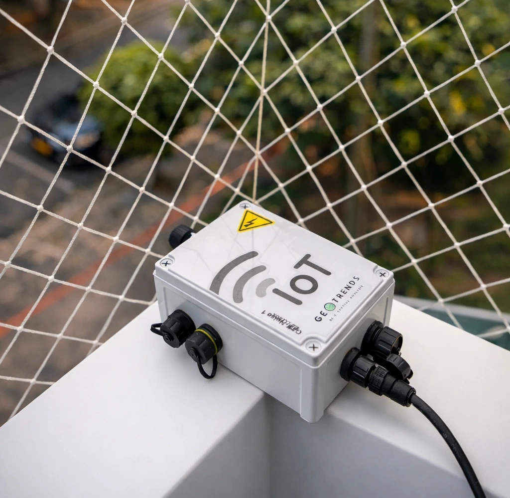
IoT
We implement smart acoustic monitoring networks based on IoT sensors that measure, analyze, and visualize the sound conditions of the territory in real time. Our systems generate advanced acoustic indicators and time series that support institutional management, public policy evaluation, and data-driven decision-making to improve the acoustic quality of cities.
View projects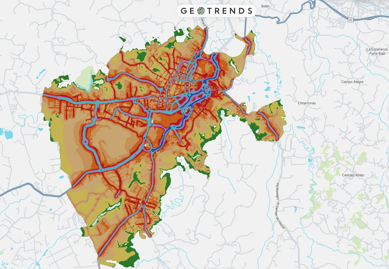
Noise maps
We develop strategic noise maps using advanced acoustic modeling and geoinformatics tools to identify dominant sources of noise pollution, estimate population exposure levels, and prioritize mitigation measures. These maps integrate with territorial planning instruments and support regulatory processes and urban environmental management.
View projects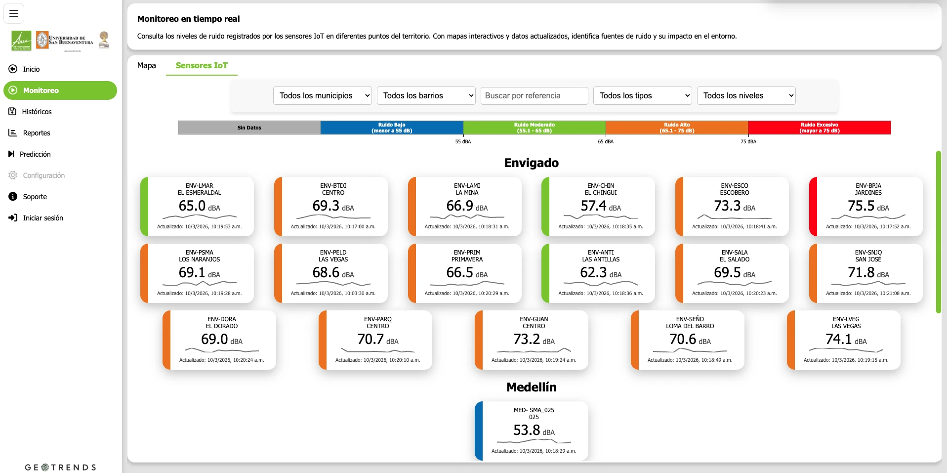
WEBGIS ecosystems
We design digital ecosystems based on WebGIS platforms that integrate multiple sources of territorial information, IoT sensors, and environmental databases into interactive analysis and visualization environments. Our platforms ingest, process, and analyze georeferenced information for monitoring environmental variables, generating dynamic indicators, and visualizing map layers in real time. These ecosystems enable data traceability, advanced spatial analysis, and strategic decision-making for environmental management, territorial planning, and strengthening institutional capabilities.
View projects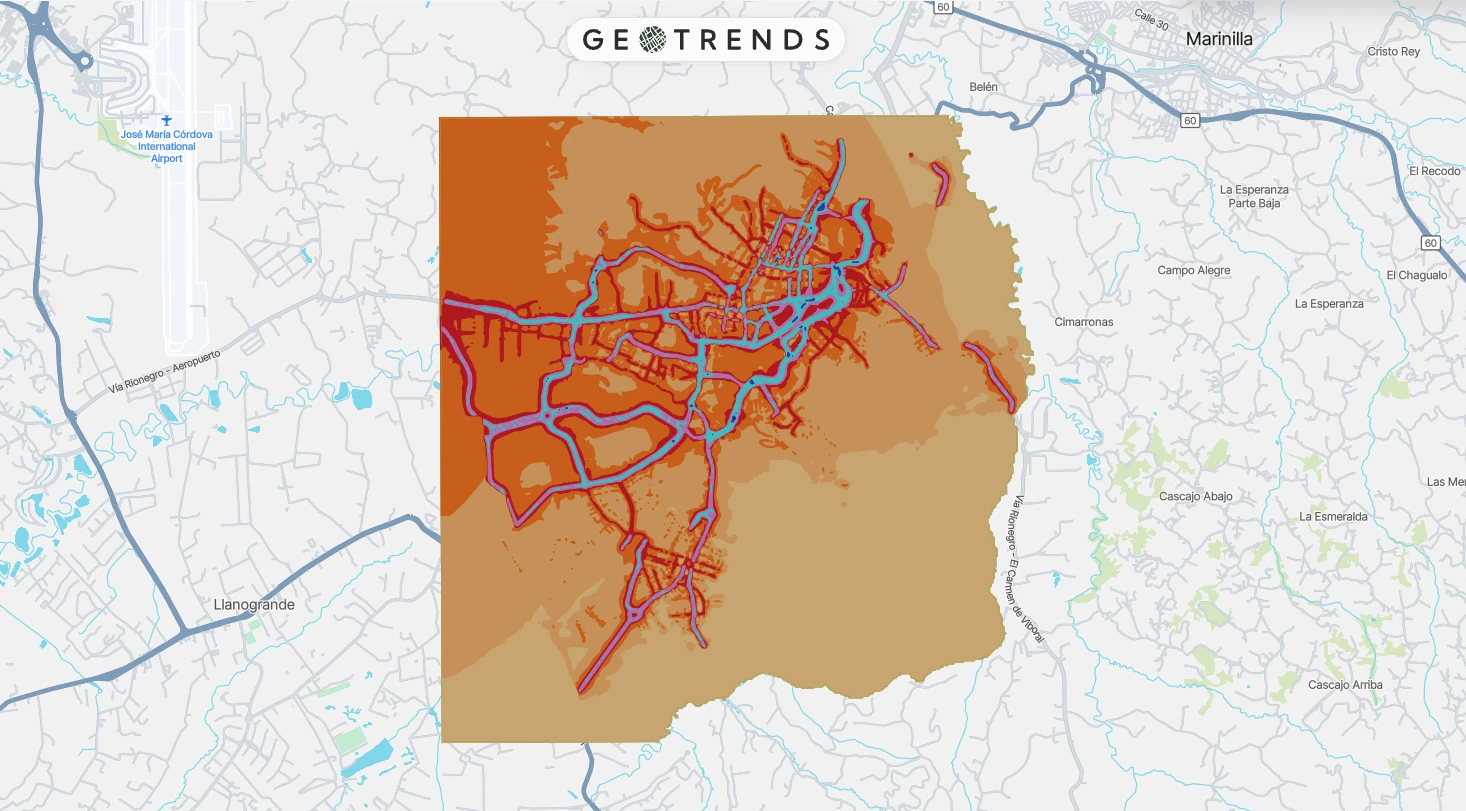
Acoustic remediation plans
We develop acoustic remediation plans under a comprehensive approach that combines technical diagnosis, territorial prioritization, and short-, medium-, and long-term intervention strategies. Our plans incorporate analytical and technological tools that facilitate institutional coordination, action traceability, and the integration of noise into environmental planning.
View projects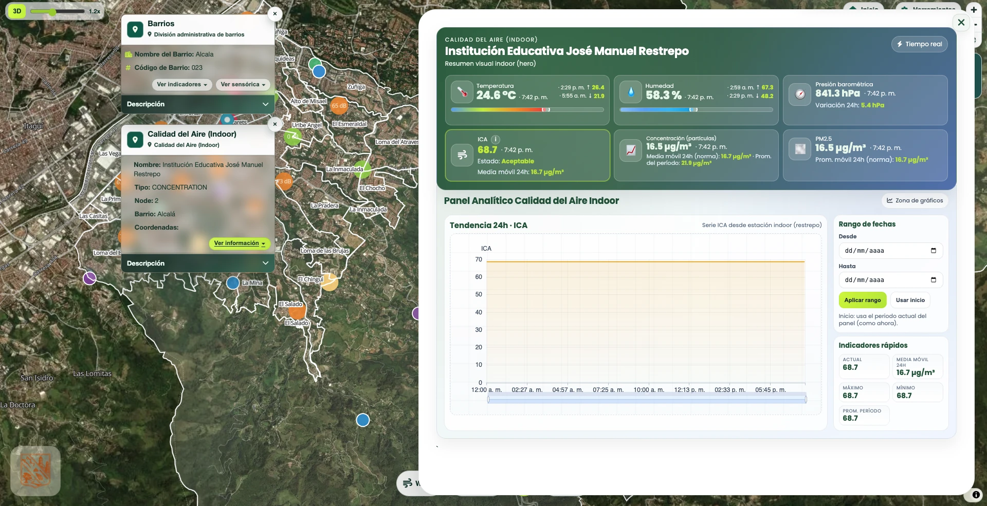
Geospatial analytics
We apply advanced geospatial analytics to integrate, process, and analyze large volumes of territorial information from sensors, IoT systems, geographic databases, and multiple environmental and urban sources. Through spatial analysis techniques, data modeling, and cartographic visualization, we transform georeferenced information into strategic indicators that help identify territorial patterns, understand complex spatial dynamics, and support decision-making in urban planning, environmental management, infrastructure, and territorial development.
View projects